

Icebergs. They sink ships, provide refuge for seals and polar bears, and they are something most people never see. We did not want to be most people.
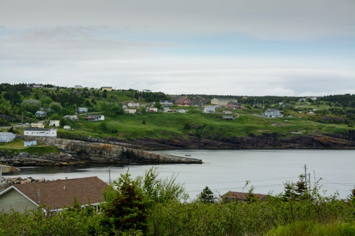
After arriving at the port in Argentia, we drove north and we checked into the Banberry House Bed and Breakfast in St. Johns. A beautiful town, it is full of colorful homes on a hilly landscape. We woke up the next morning to rain and had to stand in line at Costco to fix our leaking tire. Once that was taken care of, we were off to go even further north, towards Flatrock, a strange name indeed, but would prove to be accurate.
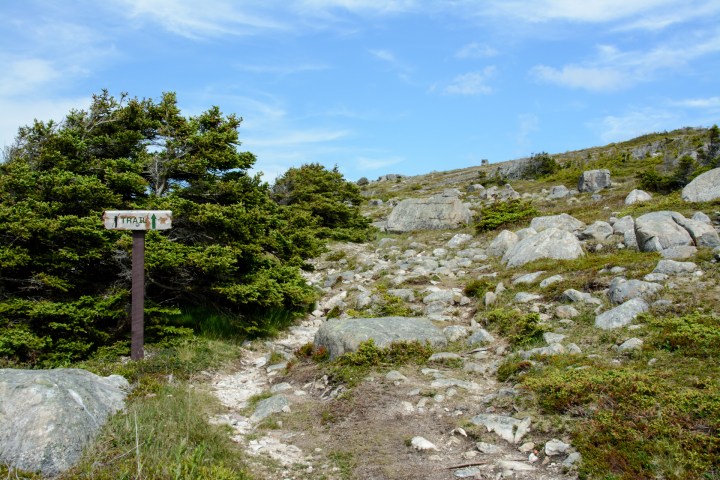
As we drove down a winding road, we saw a small trailhead that looked interesting. There are many footpaths in this area and we were not sure if this is the one we wanted. We parked the car, walked down to the water, and enjoyed standing on the cliffs and gazing out to sea. We were looking for the Father Troy’s Trail that runs from Flatrock to Torbay and this was not it so we headed out to continue our trek northwards. We did finally see a sign that told us we were on the East Coast Trail and that trail runs over 300 km. It must be a beautiful hike!


Suddenly, in the distance, we see a white thing in the water. Could it be? Yes, it was an iceberg! Now we have to figure out how to GET to the iceberg.

After driving up into a neighborhood and around sharp curves on a hill, we arrived at a spot where there was some construction, water, and some really big rocks. We parked the car and started walking out into the area where we thought the iceberg was floating. We discovered that we are on a huge rock that juts out into the ocean. There seemed to be a path ahead so onward we went.
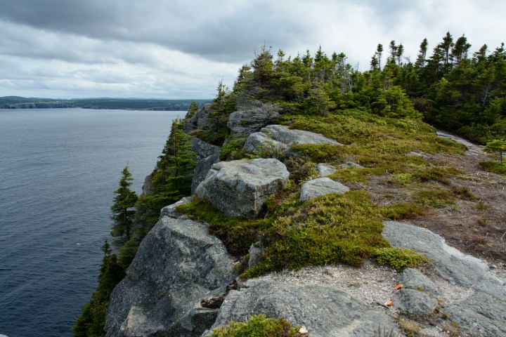
The trail starts out at the base of the Beamer, a barren slab of rock that juts out into the Atlantic. We hiked out to the point and saw the iceberg. It looks a bit bigger than it did from a distance. Now to get closer.

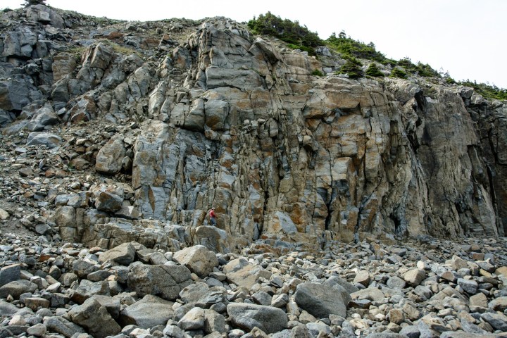
We walked along the coast, following the trail, and looked down. We saw some people on the rocks and what looked like a path so we set off to find where it started The path was dubious at best. Oh boy. Narrow with lots of loose tiny racks that fell down to very large boulders. A bit hairy in parts but we did make it down.
Now we were even closer to the berg! At this point, we were able to see how far below the water it reaches, showing us why these floating icebergs are so dangerous to boats. A small tourist boat approaches the iceberg as we watch, but they are very careful not to get too close. The berg seems to be getting bigger!


Unfortunately, we could not get super close at this level, as there was a straight cliff in front of the berg. Now we have to go back up and try to find a way to be over the top of the berg. We see a small path through the trees and low brush and suddenly we burst out at the top.


We walk to the edge and… score! We are over the top of the iceberg and it is huge. Now, how cool is that?

Moose sightings: 0
